


Abel Tasman Track - Preparation, Stages, Tips & Tricks
Discover the northern tip of the South Island on New Zealand’s sunniest multi-day hike | ©️ Te Pania Noonan
Overview
- Intro
- Step 1 - The Preparation
- Step 2 - The Hike
- Other - By Water
- Other - I Need Help
- Frequently Asked Questions
Nils (Team KiwiQuest)
Exploring New Zealand on foot is not only the cheapest but arguably the most spectacular option. Today we’re introducing you to the Abel Tasman Track, which will lead you to the most beautiful sandy beaches and directly to Cleopatra’s Pool in three to five days.
Already convinced?
Rightly so! Let’s do it!
Intro

Our Hike...
Nils’ attempt to hike the Abel Tasman Track wasn’t exactly one of his finest moments. Instead of bringing enough food, he only packed a few carrots. Eureka, that backfired quite badly.
Luckily, Anna had enough grub with her.
Still, she was: Not amused.
Oh well! Nils now knows better and will pack a bit more food next time. And while he’s at it, get himself a better backpack. Right, Nils? Mh? Mh?
Step 1 - The Preparation
The Abel Tasman Coast Track is a three to five-day hike that you can complete year-round in both directions. The route is not a loop but is suitable for beginners and advanced hikers alike.
Thanks to numerous accommodation options, the Abel Tasman can accommodate significantly more tourists simultaneously than other Great Walks. Nevertheless, you must book early and plan your route.
The Stages
-
Step 1 Marahau Duration: approx. 4 hours | Difficulty: Easy
-
Step 2 Anchorage Duration: approx. 3.5 hours | Difficulty: Medium
-
Step 3 Bark Bay Duration: approx. 4.5 hours | Difficulty: Hard
-
Step 4 Awaroa Duration: approx. 5.5 hours | Difficulty: Medium
-
Step 5 Whariwharangi Bay Duration: approx. 2 hours | Difficulty: Hard
-
Step 6 Wainui Bay You made it!
The Route
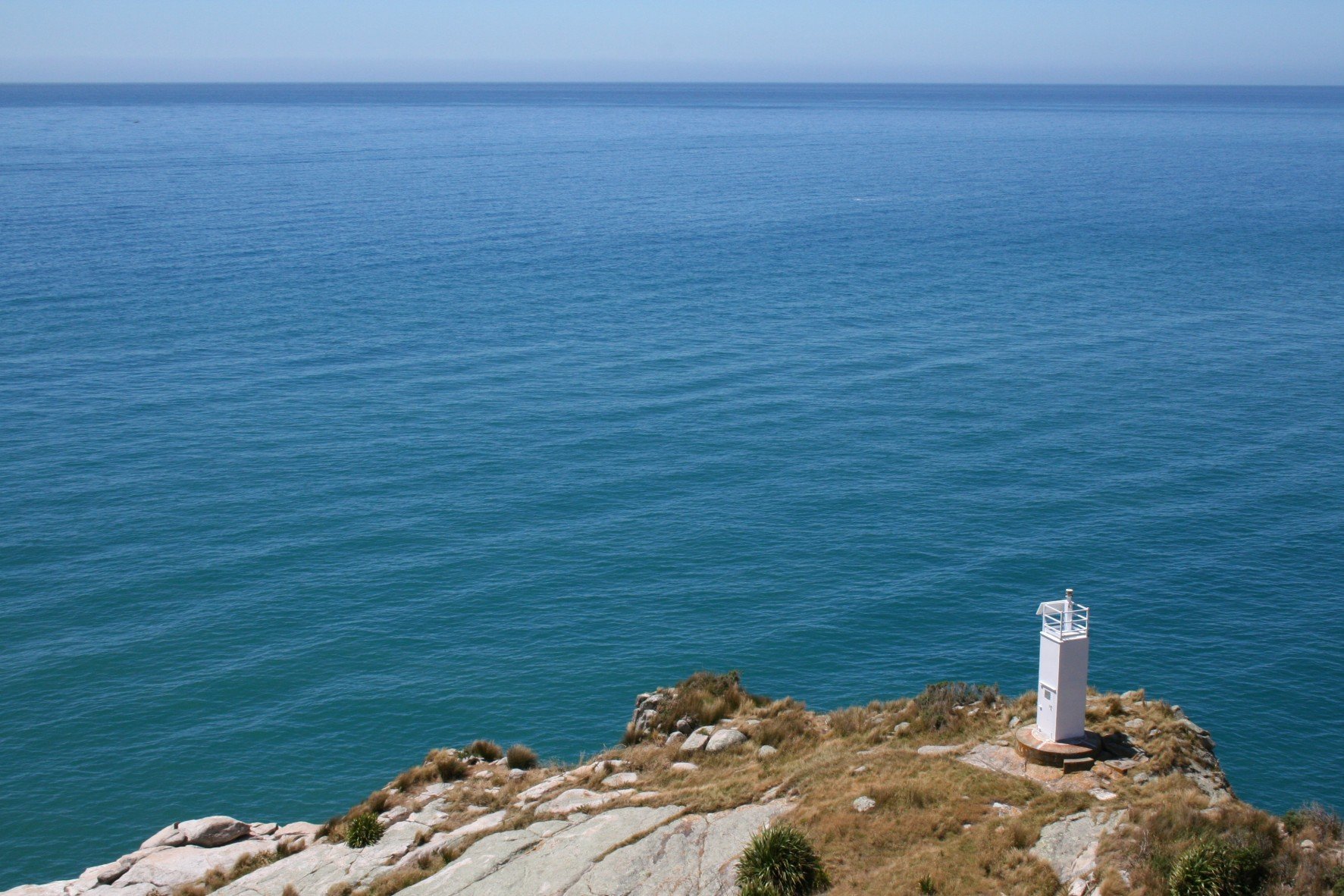
The Abel Tasman Coast Track is one of the longer Great Walks in New Zealand at 60 kilometers. However, you will be rewarded with beautiful white sandy beaches along this stretch, inviting you to pause.
Numerous junctions lead away from the coast, where there’s much to discover. When planning, keep in mind that the track goes through a bay you can only cross at low tide.
Note:
How does the path feel?
The Planning
The most important thing you need to consider for the Abel Tasman Coast Track is booking. The track is open year-round, and without a ticket, you will not be admitted to accommodations. In the worst case, you could face a hefty fine, and you could be removed from the national park.
Note:
Food & Rubbish
Note:
Recommended Equipment
Let's Get Started
That’s it for route planning and preparation. You’ll collect your booked tickets and your track guide from the DOC Visitor Centre in Nelson before starting your hike. For more information on planning your hike perfectly, visit the New Zealand Mountain Safety Council.
Now the hike can finally begin!
Ready for it? Yeah!! Let’s go!
Step 2 - The Hike
There are quite a few highlights. We want to introduce you to our favorites here. If there's an absolute highlight missing, please add it in the comments. We'll include it in the article.


Stage 1: Marahau
At the beginning of your hike, you’ll cross the river mouth over the Marahau Dam before the track leads you through lush beech forests inland. It winds through several small gorges until you finally return to the coast, where you’re rewarded with a great view of Anchorage Bay.
Note:
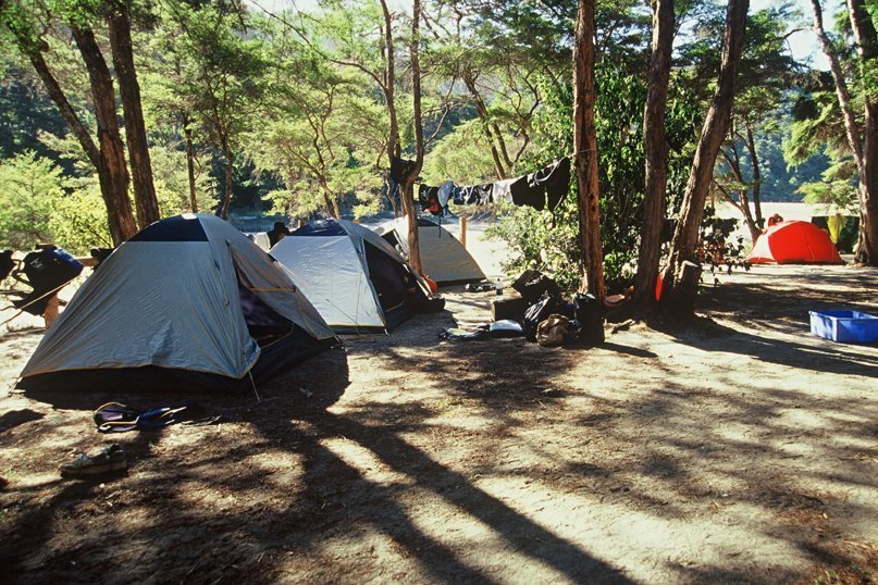
Accommodation
Note:
Worthwhile Detours
Stage 2: Anchorage
Today you have to decide which route you want to take. Just beyond Anchorage is the Torrent Bay estuary, which you can only cross two hours before and after low tide. Check the tide times in advance. If the estuary is inaccessible, you’ll have to take the longer path.
The highlight is a 47-meter-long suspension bridge over the Falls River. From there, continue through rich coastal forests until you finally reach the golden sandy beach of Bark Bay.
Note:
Accommodation
Note:
Worthwhile Detours
Stage 3: Bark Bay
Once again, you have a river crossing today that you can only carry out within 2 hours before and after low tide. Alternatively, the detour is just 10 minutes this time. Then it gets a bit more challenging. A steep climb leads you over Mosquitoy Bay to Onetahuti Bay, where one of the longest sandy beaches in the entire national park awaits you.
Note:
Accommodation
Note:
Worthwhile Detours
Stage 4: Awaroa
Today it’s definitely all about the right planning. The Awaroa Bay, over which the Abel Tasman Track continues, can again only be crossed two hours before and after low tide. And this time, there’s no detour.
But hey, in the worst case, you can simply stay on the beach a little longer and relax! Today’s trail is mostly flat, and the landscape changes from golden sandy beaches to rocky headlands full of native Kānuka.
Note:
Accommodation
Note:
Worthwhile Detours
Note:
Early Finish
Stage 5: Whariwharangi Bay
On the last day, it gets quite intense – or rather high up. The path to the Wainui headland is hilly and steep, but you’re rewarded with a magnificent view of the bay.
You Made It!
That’s it! You made it. Time for a well-deserved break. We hope the hike was a great adventure for you. Feel free to share your experiences in the comments.
We’re excited to hear!
Other - By Water
Yes, you read correctly. The Abel Tasman Track can not only be completed on foot but also partially by kayak. We haven’t tried it ourselves yet, but we’re keen to! Here are the best routes with average times:
The Stages
-
Step 1 Marahau to Watering Cove Duration: 3 hours
-
Step 2 Marahau to Anchorage Duration: 4 hours
-
Step 3 Anchorage to Bark Bay Duration: 2 hours
-
Step 4 Bark Bay to Onetahuti Duration: 1.5 hours
Even if you’re kayaking, you must adhere to the rules on the track and book your accommodation in a tent or hut in advance. North of Onetahuti, kayaking is not recommended for safety reasons.
Other - I Need Help
Can you carry me? No! Grrr! We can't help you with the hike itself, of course. But we've got a handy download for you to print out and take with you. Later it will be a beautiful memory!
Discover the northern tip of the South Island on New Zealand’s sunniest multi-day hike | ©️ Te Pania Noonan
AnsehenFrequently Asked Questions
What other KiwiQuesters wanted to know...
User question:
What are the huts equipped with?
User question:
What time of year is the hike most worthwhile?
User question:
What if I take longer than planned on the track?
Camper Purchase with Buyback Guarantee: The Insider Tip for New Zealand
The most popular concept for camper purchase in New Zealand is back
Reserve SpotWie gehts weiter?
Wanderungen
We wish you an amazing adventure!
Welcome to Team KiwiQuest!
Team KiwiQuest
